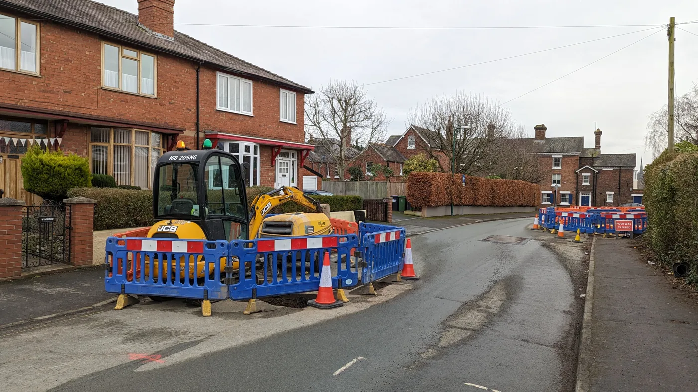

The A458 from Shrewsbury to Wales shuts four nights, 5 to 8 October, and the A5 bypass westbound on the 5th. Castle Foregate and Raven Meadows dates too.
The A458 from Shrewsbury towards Welshpool now shuts for four nights, not two. National Highways’ latest closure report has the road closed in both directions from the Churncote roundabout to the Welsh border, 8pm to 6am, on the nights of Monday 5 to Thursday 8 October.
On the first of those nights, Monday 5 October, the A5 westbound between Bayston Hill and Edgebold also shuts, from 9pm to 6am. That is the southern stretch of the Shrewsbury bypass. On Thursday night the A5 north of Oswestry closes too, between Gledrid roundabout and Chirk.
Castle Foregate in Shrewsbury closes for four nights, Monday 5 to Thursday 8 October, so Network Rail can carry on fitting pigeon-proofing mesh under the railway bridges.
Live now and this week:
- A458, Churncote roundabout to the Welsh border, closed both ways 8pm to 6am, nights of 5, 6, 7 and 8 October
- A5 westbound, Bayston Hill to Edgebold, closed 9pm Monday 5 October to 6am Tuesday
- A5 both ways, Gledrid roundabout to Halton roundabout at Chirk, closed 8pm Thursday 8 October to 6am Friday
- Castle Foregate, Cross Street and Howard Street, Shrewsbury, closed 8pm to 6am, 5 to 8 October
- Frankwell, Shrewsbury, closed one way into town, 11pm to 6am, to Wednesday 7 October
- Coalport Road, Broseley, closed 9.30am to 4pm each weekday to Wednesday 7 October
- Woodhouse Lane, Albrighton, full closure, 8am to 5pm, Monday 5 to Friday 9 October
What is still to come:
- Longden Road between Red Hill and Nobold, near Shrewsbury, full closure, 9.30am to 3pm, 12 to 16 October
- Sheinton Street, Much Wenlock, full closure on weekdays, 9.30am to 4pm, 12 to 21 October
- A4169 from Shifnal to The Hem, including the Bridgnorth Road roundabout, full closure on weekdays, 9.30am to 4pm, 19 to 28 October
- Raven Meadows, Shrewsbury, full closure on weeknights, 8pm to 6am, 21 October to 4 November, for a new raised crossing
- Pothole repairs by the council’s Multihog crews on eight days, 5 to 27 October (full list below)
- Castle Foregate, more Sunday mornings and overnight runs to 8 November
This page was last checked against the council’s own pages and the National Highways closure report on 5 October 2026.
The A458 shuts four nights, the A5 two
National Highways’ seven-day closure report dated 2 October covers Friday 2 to Thursday 8 October. It now lists the A458 closure on four nights. The report we checked on 1 October had it on two.
| Road | Where | When |
|---|---|---|
| A458 both directions | A5 Churncote roundabout to the Welsh border, carriageway closed | 8pm to 6am, nights of Monday 5 to Thursday 8 October |
| A5 westbound | Bayston Hill to Edgebold, carriageway closed | 9pm Monday 5 October to 6am Tuesday |
| A5 both directions | Gledrid roundabout to Halton roundabout, carriageway closed | 8pm Thursday 8 October to 6am Friday |
Churncote is the roundabout where the A458 leaves the A5 on the western edge of Shrewsbury. Bayston Hill to Edgebold is the bypass on the town’s south western side, between the A49 and the A488. Both are closed for maintenance, with a diversion “via National Highways and local authority network”. Eastbound traffic on the A5 is not affected.
The Thursday closure is at the county’s northern tip. Gledrid roundabout is in Shropshire, by Weston Rhyn, about four miles north of Oswestry. Halton roundabout is across the border at Chirk, in Wrexham county. The report lists it as maintenance on behalf of NMWTRA, the North and Mid Wales Trunk Road Agent.
The report lists nothing on the A49 or on the Shropshire stretch of the M54 this week.
These are trunk roads, not the council’s, and none of these closures has appeared on the council’s newsroom or its works list. The report is republished every day, and National Highways changes the spreadsheet’s web address each time, so an old saved link quietly serves an out-of-date week. Start from the closure report page.
Castle Foregate: four nights this week
The railway bridge works at Castle Foregate were due to finish on 11 September. Network Rail found more steelwork to repair, and the scheme now runs to 8 November. The second four-night run for the pigeon-proofing mesh is 5 to 8 October, and the next is 12 to 15 October. The full list of remaining dates is further down this page.
The footpath along one side of Castle Foregate stays shut for the whole scheme, with a signed diversion to the footpath on the other side.
Raven Meadows: weeknights from 21 October
Shropshire Council has added a new scheme to its works list: a new raised pedestrian crossing on Raven Meadows in Shrewsbury town centre. The scheme page says:
- Raven Meadows will be fully closed, 8pm to 6am each weeknight
- the work runs from Wednesday 21 October to Wednesday 4 November
- the one-way system is suspended while it is done, so drivers can still reach the hotel, the multi-storey car park and the businesses
- deliveries to the Darwin Shopping Centre go in through the bus station
- there is a signed diversion for everyone else
The page’s own heading gives the start as 20 October and its text as 21 October. We have used the date in the text, which is the more detailed of the two. The council warns the dates may change because of the weather.
Bridges and the A456: still no word
Shropshire Council closed three bridges in September, all 24 hours a day: Horse Bridge near Minsterley and Rhiew Revel Bridge near Pant to 25 September, and Tetchill Bridge near Ellesmere to 30 September. Checked again on 5 October, the council has published nothing to change those dates and nothing to say any of them has reopened. The same goes for the A456 at Boraston, whose works list entry still shows an estimated finish of 21 September. They should all be open by now, but we cannot confirm it from the council’s own pages.
What closes when
Five roads resurfaced, from Broseley to Shifnal
Five Shropshire Council resurfacing closures are live or booked, all carried out by Kier Infrastructure. Each is a full closure in working hours with a signed diversion, and each keeps access for emergency vehicles on blue light calls.
- Coalport Road, Broseley, closed 9.30am to 4pm each weekday to Wednesday 7 October (announced 15 September)
- Woodhouse Lane, Albrighton, closed 8am to 5pm from Monday 5 to Friday 9 October (announced 17 September)
- Longden Road between Red Hill and Nobold, near Shrewsbury, closed 9.30am to 3pm from Monday 12 to Friday 16 October (announced 24 September)
- Sheinton Street, Much Wenlock, closed 9.30am to 4pm on weekdays from Monday 12 to Wednesday 21 October (announced 25 September)
- A4169 from Shifnal to The Hem, including the Bridgnorth Road roundabout and its approaches, closed 9.30am to 4pm on weekdays from Monday 19 to Wednesday 28 October (announced 29 September)
The Albrighton job is the one to read twice, because Shropshire has two villages of that name. This is the WV7 Albrighton, near Shifnal and about twenty miles south east of Shrewsbury, not the Albrighton on the A528 just north of the county town. The council’s notice says Woodhouse Lane runs from the A41 to the A464. Its hours are also longer than the rest, 8am to 5pm rather than the usual 9.30am start, so it takes out both peaks.
The Longden Road closure is on the south western approach to Shrewsbury. Its notice keeps access for residents and businesses inside the closure, but unlike the others it does not list pedestrians, cyclists or riders among those let through.
The Sheinton Street work runs on weekdays only, so the road is open over the weekend of 17 and 18 October. The A4169 job is also weekdays only, so no closure is listed for the weekend of 24 and 25 October. The council asks people not to leave cars parked on the road while it is done.
Most of these are on the council’s 2026/27 resurfacing programme, which lists 92 stretches of road for this financial year. Worth knowing before you rely on that list: its “work completed” column is blank for all 92 entries, so the page tells you what is planned and nothing about what is done.
Frankwell shut one way overnight to 7 October
Frankwell in Shrewsbury is closed one way overnight until Wednesday 7 October, while Severn Trent Water runs CCTV surveys and cleans its sewers.
The detail that decides whether it affects you is the direction. The closure stops traffic coming into the town centre from Frankwell Roundabout. Traffic going the other way, out of town, is not stopped. It runs 11pm to 6am only, and the council’s notice says there will be no work on Friday or Saturday nights, so six nights are affected rather than eight. Access is kept to homes and businesses inside the closure, with a signed diversion for everyone else.
The notice went up on the newsroom on 18 September and is on no other council page. Nothing has been published since to change it.
Castle Foregate: every remaining date to 8 November
The railway bridge works at Castle Foregate in Shrewsbury were due to finish on 11 September. Network Rail found more steelwork to repair, and the scheme now runs to 8 November. The bridges stay open to vehicles in the daytime.
The council’s 11 September notice splits the remaining closures of Castle Foregate, Cross Street and Howard Street into three runs:
| Dates | Hours | What for |
|---|---|---|
| Sundays 11, 18 and 25 October, 1 and 8 November | 12.30am to 7am | Early morning Sunday closures |
| 5 to 8 October (this week), 12 to 15 October | 8pm to 6am | Installing pigeon-proofing mesh |
| 18 to 19 October, 25 to 26 October, 1 to 2 November, 8 to 9 November | 8pm to 6am | Dismantling the scaffolding |
The footpath along one side of Castle Foregate stays shut to pedestrians for the whole scheme, with a signed diversion to the footpath on the opposite side.
Our Castle Foregate closures page has the diversion arrangements and the pedestrian route.
Pothole repairs: the October list
Shropshire Council’s Multihog road planers cut out a squared hole for a following gang to fill, which the council says is quicker than breaking out a defect by hand and cuts down on road closures. The October programme, published on 28 September, runs two machines across nine locations, weekdays between 9.30am and 4pm unless a shorter window is given:
- Monday 5 October: Pulverbatch, Hollies junction to Long Lane crossroads, Shrewsbury; and Cooks Cross, Alveley (9.30am to 2.45pm)
- Friday 9 October: Birch Grove, Alveley
- Monday 12 October: Comley junction to Manor Farm junction, Cardington
- Tuesday 13 October: Butterfield Lane End to the B4385 junction at Three Ashes, Hopton Castle
- Monday 19 October: Washford Road, Shrewsbury (9.30am to 2.45pm)
- Tuesday 20 October: Rosehill Drive, Bridgnorth
- Thursday 22 October: Watling Street, Craven Arms
- Tuesday 27 October: Sydney Cottage Drive, Bridgnorth
Our October pothole repairs story has the detail.
What the council’s own works list says
Shropshire Council’s large-scale project works list holds three entries on 5 October. It carried 19 at the start of September and two at the end of it. The new one is the Raven Meadows crossing.
| Where | What | Estimated finish |
|---|---|---|
| A456 Boraston, Bowerswood to the Peacock Inn | Burst driven mains renewal, road closed | 21 September, now passed |
| Raven Meadows, Shrewsbury | New raised pedestrian crossing, full closure on weeknights | 4 November |
| A488 Hope Valley | Landslip repairs, marked "now completed" | 31 January |
One older entry is marked finished. The A456’s estimated finish date passed two weeks ago without the entry being removed or updated. The council has not said whether the A456 has reopened, so we cannot tell you that it has. Treat a passed date on that list as “probably finished, worth checking” rather than “reopened”.
That is the wider point. The list has never carried the three bridge closures, or the Bridgnorth, Whitchurch, Broseley, Ludlow, Shrewsbury and Albrighton resurfacing, all of which are newsroom announcements only. It carries nothing on the M54, because that is National Highways’ road. And it carries nothing on the Frankwell sewer work.
Always check the live map before you rely on this list. The council publishes an interactive roadwork map built on one.network, which shows every permitted dig including the small ones, who is doing it, and the dates. It updates constantly. A page like this one cannot.
Flooding on the roads
Shropshire’s highway drainage network can be overwhelmed quickly in a thunderstorm, because water runs off surrounding land onto the road. That is the council’s own explanation, given when it put its highways service on standby for the thunderstorms at the end of August, with in-house drainage teams, contractors Kier and Multevo, and an incident room ready to open. Most of that flooding is temporary and drains away once the storm passes.
What to do about it:
- Do not drive through flood water
- Report flooding through improvingyourroads.shropshire.gov.uk
Have your say